Megaliths of Menez Bré
Notes about megaliths and other monuments around Menez Bré, Brittany, France.
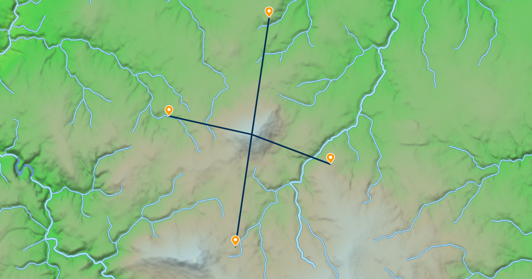
The Menez Bré hill is part of the Armorican massif, a geological formation in Western France. It has an elevation of 302 meters and is situated 100 to 150 meters above the surrounding terrain.

There are three menhirs located at approximately equal distances to the west, north, and east of Menez Bré. Additionally, there is a more recent tumulus situated at an equal distance to the south.
Chapel of Saint-Hervé (48.5763, -3.3078)
- 0 km of Menez Bré
Menhir of Crec'h Coulm (48.61013, -3.30027)
- 3.80 km north of Menez Bré
- 7.5 m tall
Stele of Saint-Michel (48.58381, -3.3607)
- 4.00 km west of Menez Bré
Menhirs of Pergat (48.58165, -3.34425)
- 2.76 km west of Menez Bré
- 5000 BCE
- 7.6 m and 2 m, there used to be another one nearby
- Saint-Ergat
Feudal Mound of Pen-Ar-Stang (48.54375, -3.31495)
- 3.66 km south of Menez Bré
- High Middle Age
- Tumulus An Dossen, Tossen Lous (Badgers' Mound)
- Near the Carhaix-Treguier Roman road
Chapel of Saint-Jean (48.55237, -3.31412)
- 2.70 km south of Menez Bré
- Near the Carhaix-Treguier Roman road
Menhir of Restournec (48.56769, -3.27339)
- 2.70 km easth of Menez Bré
- 1.9 m broken